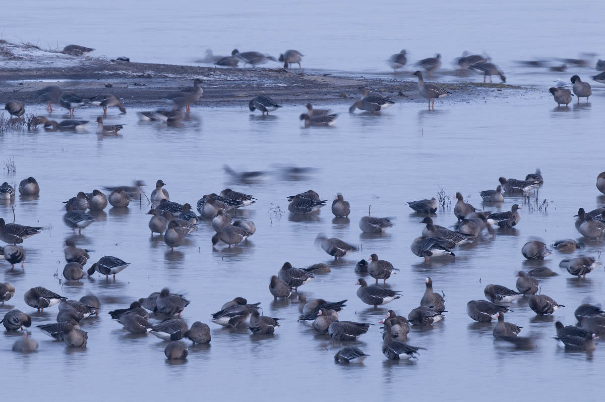
Birds flee en mass from fireworks on New Year's Eve
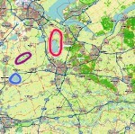
The video below, part of a new study, shows weather radar measurements from two Dutch radars during New Year's Eve. In the area enclosed between red arcs, 384,000 birds immediately respond to the lighting of fireworks just after midnight. These birds fly up to 500 meters in altitude, much higher than normally.
Annual radar measurements
The animations show images of radar reflectivity within a 40 km radius from the radar. Reflectivity abruptly increases every year at midnight as birds take off in great numbers. Dark red represents a high radar reflectivity, which is correlated with a large density of flying birds. If it rains, birds can be invisible because the reflectivity is dominated by the rain.
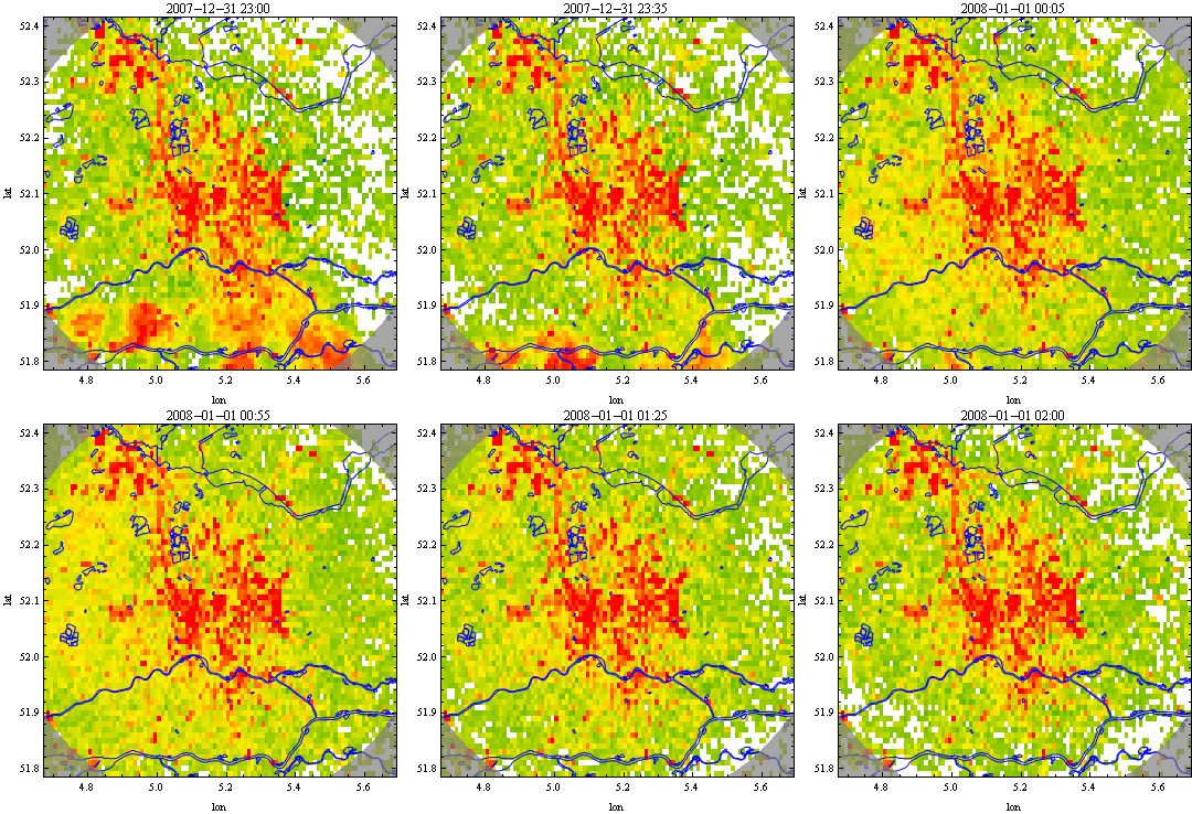
Radar image from 2007/2008. The image shows a lot of stationary reflectivity from the ground which is not due to birds. At 23:30 a few passing rain showers can be seen. At midnight the image clearly changes and very high reflectivity (orange and red colors) due to birds is seen. Large rivers and important water bodies are shown in blue.
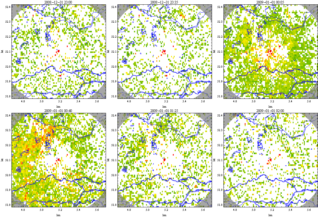
Radar image from 2008/2009. At midnight a sudden increase in reflectivity is visible (orange and red). Large rivers and important water bodies are shown in blue.
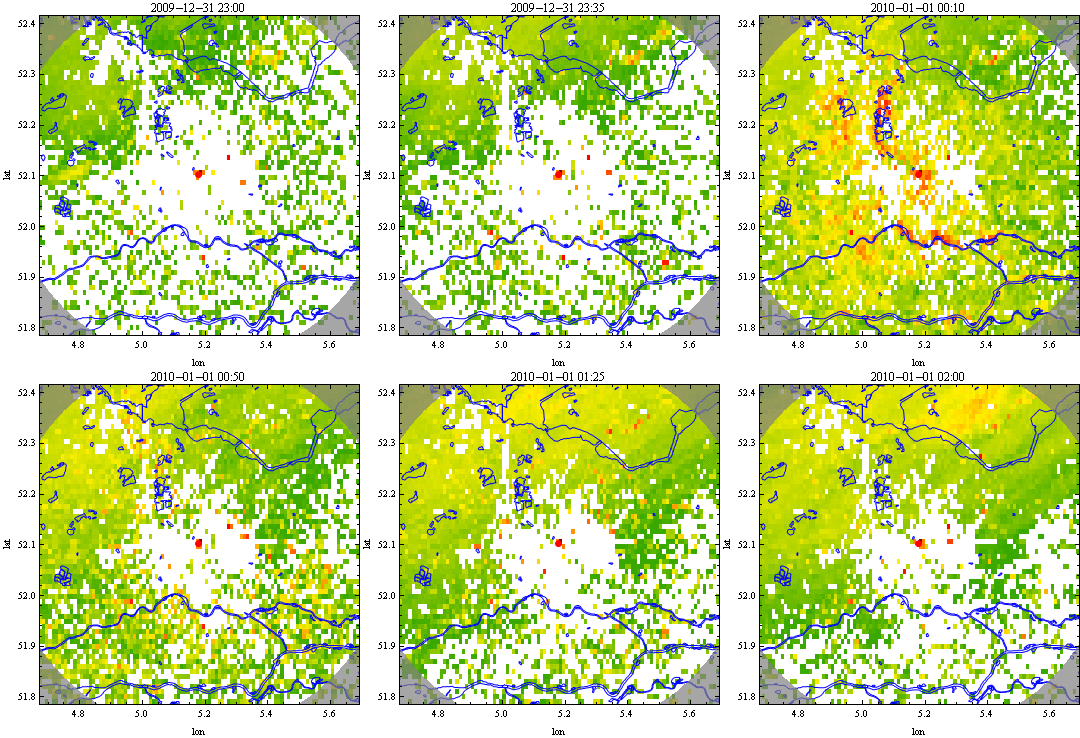
Radar image from 2009/2010. The upper half of this image shows reflectivity throughout the night due to a band of light precipitation. At midnight a sudden increase in reflectivity is visible (orange and red) due to birds in the air. Large rivers and important water bodies are shown in blue.
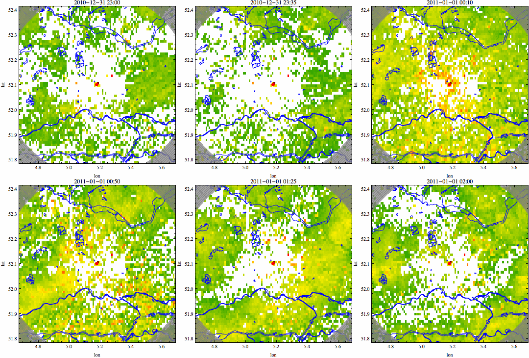
Radar image from 2010/2011. In addition to reflectivity due to rain throughout the night, at midnight a sudden increase in reflectivity is visible (orange and red) due to birds in the air. Large rivers and important water bodies are shown in blue.
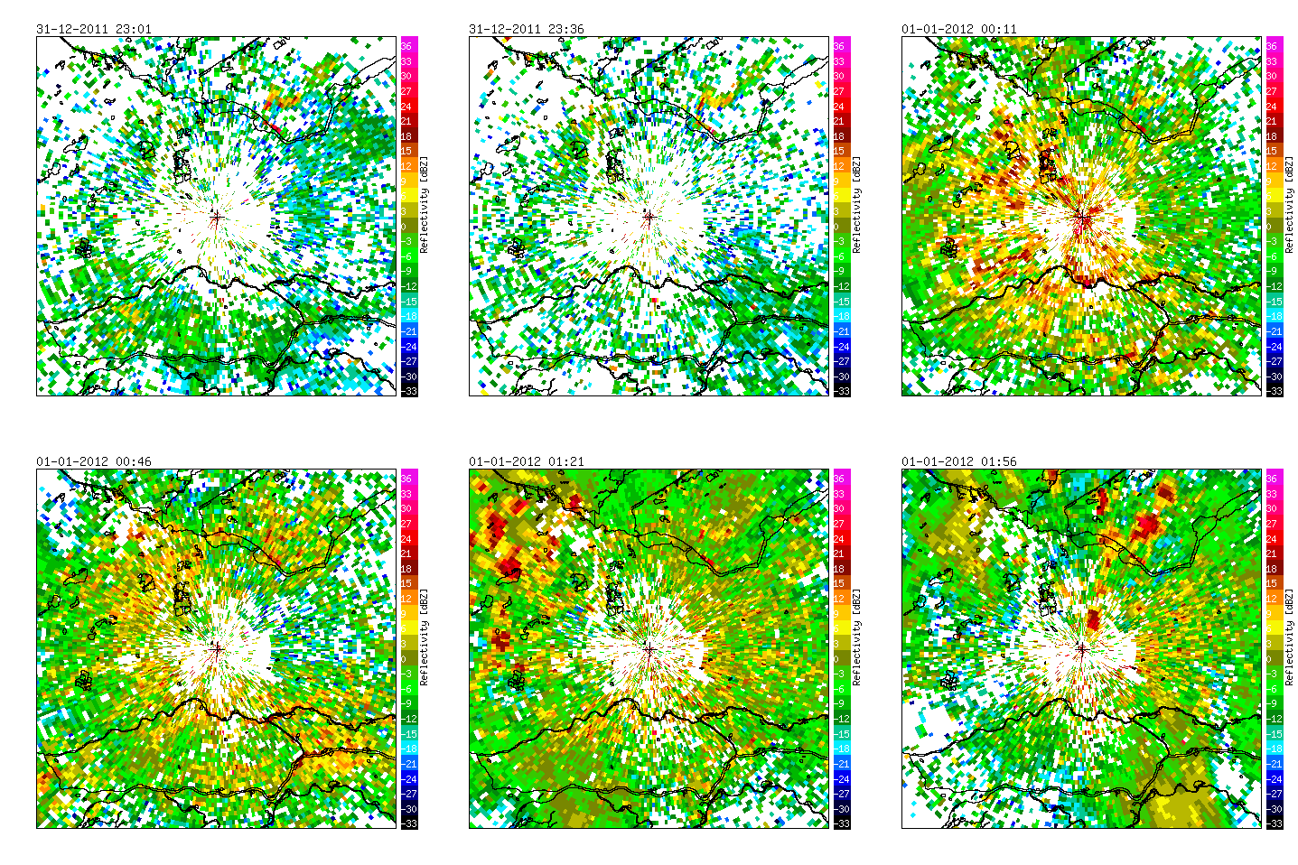
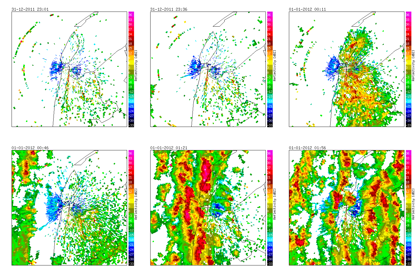
Radar measurements of Den Helder (NL), 2011/2012.
The weather radar in Den Helder is surrounded by important Natura 2000 areas for waterfowl including tens-of-thousands of waders and ducks (Waddensea, Texel and North Sea coastal area).
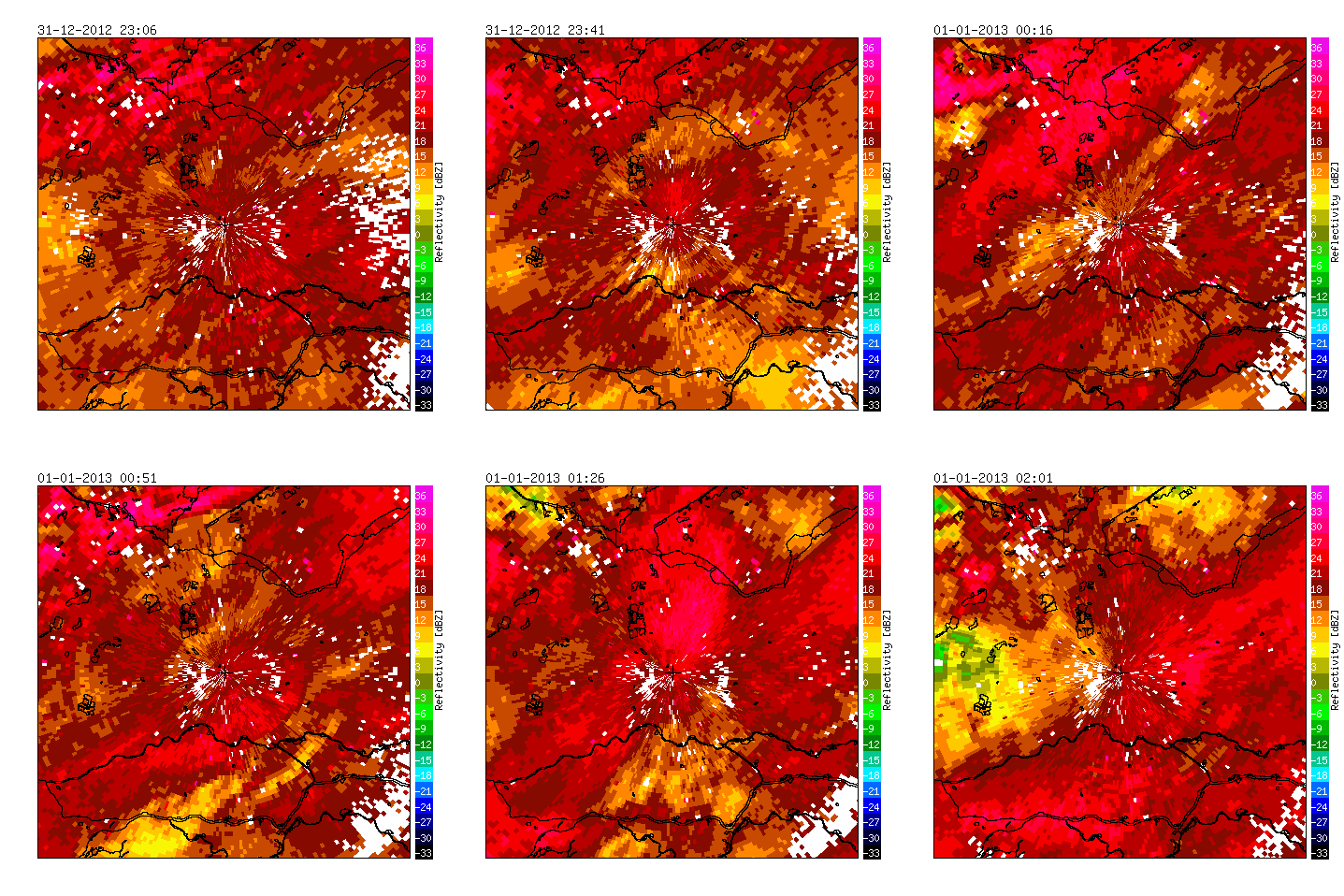
Radar measurements of De Bilt, 2012/2013. If it rains, birds can be invisible because the reflectivity is dominated by the rain, as was the case this year.
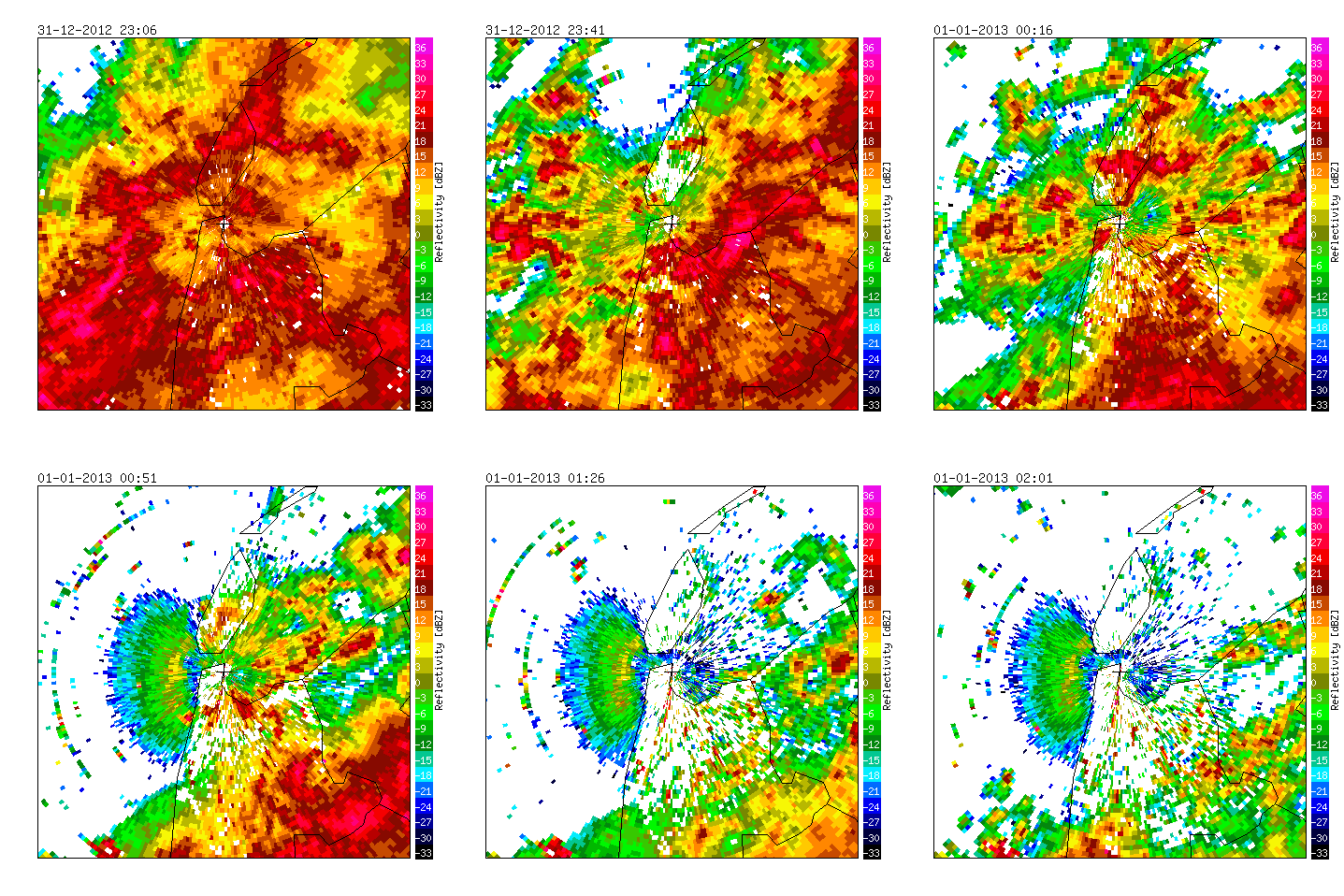
Radar measurements of Den Helder, 2012/2013. If it rains, birds can be invisible because the reflectivity is dominated by the rain, as was the case this year.
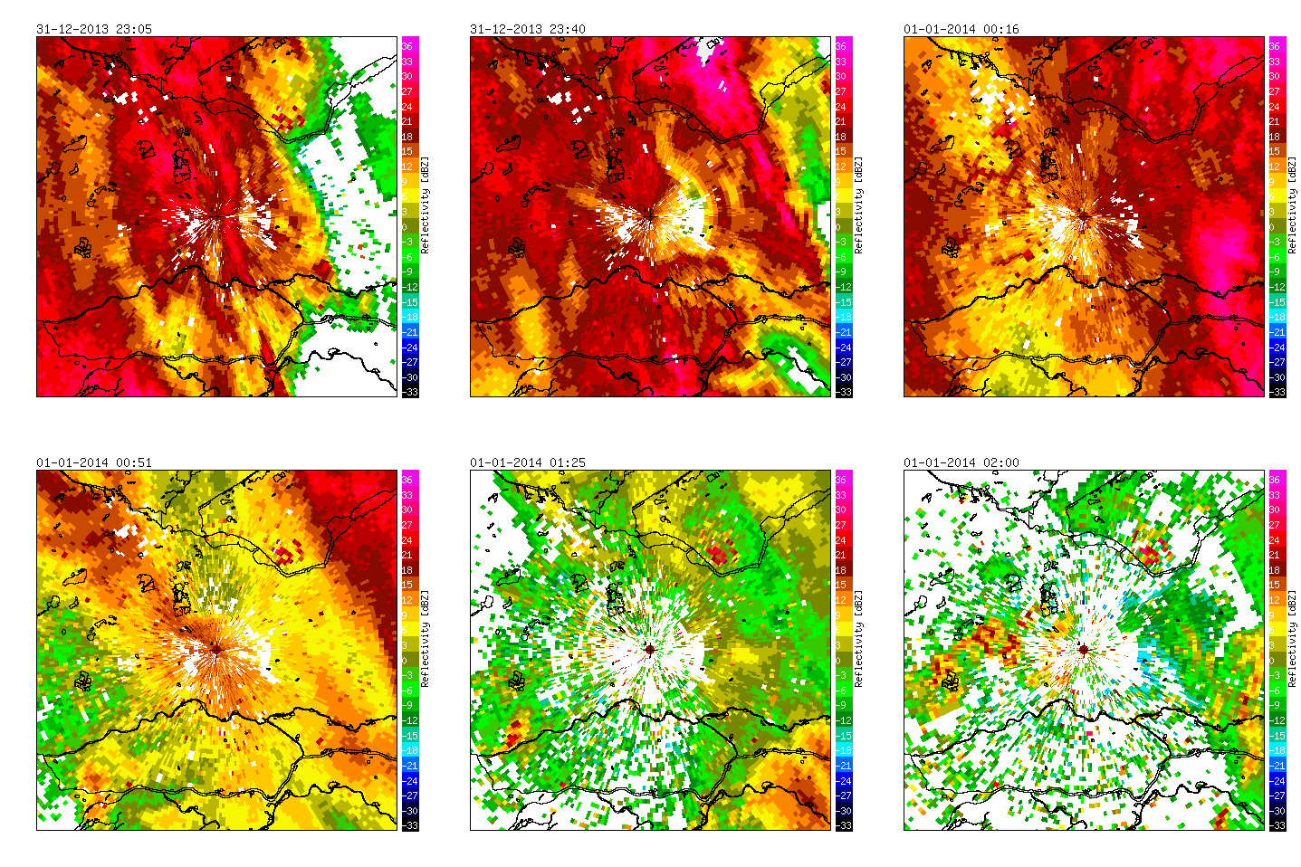
Radar measurements of De Bilt, 2013/2014. If it rains, birds can be invisible because the reflectivity is dominated by the rain, as was the case this year.
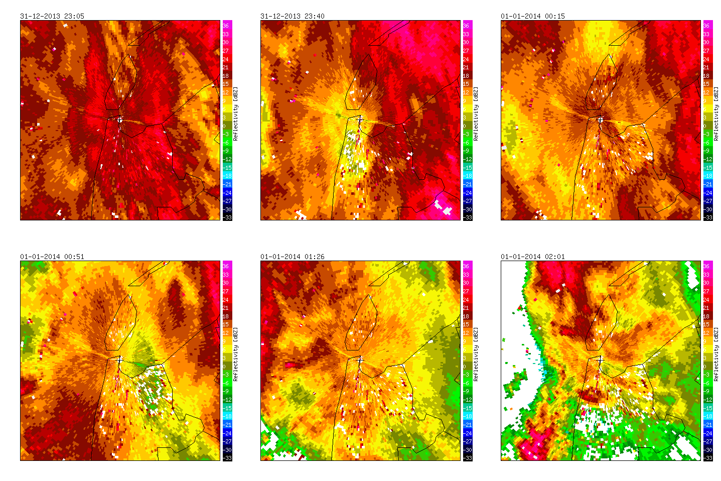
Radar measurements of Den Helder, 2013/2014. If it rains, birds can be invisible because the reflectivity is dominated by the rain, as was the case this year.
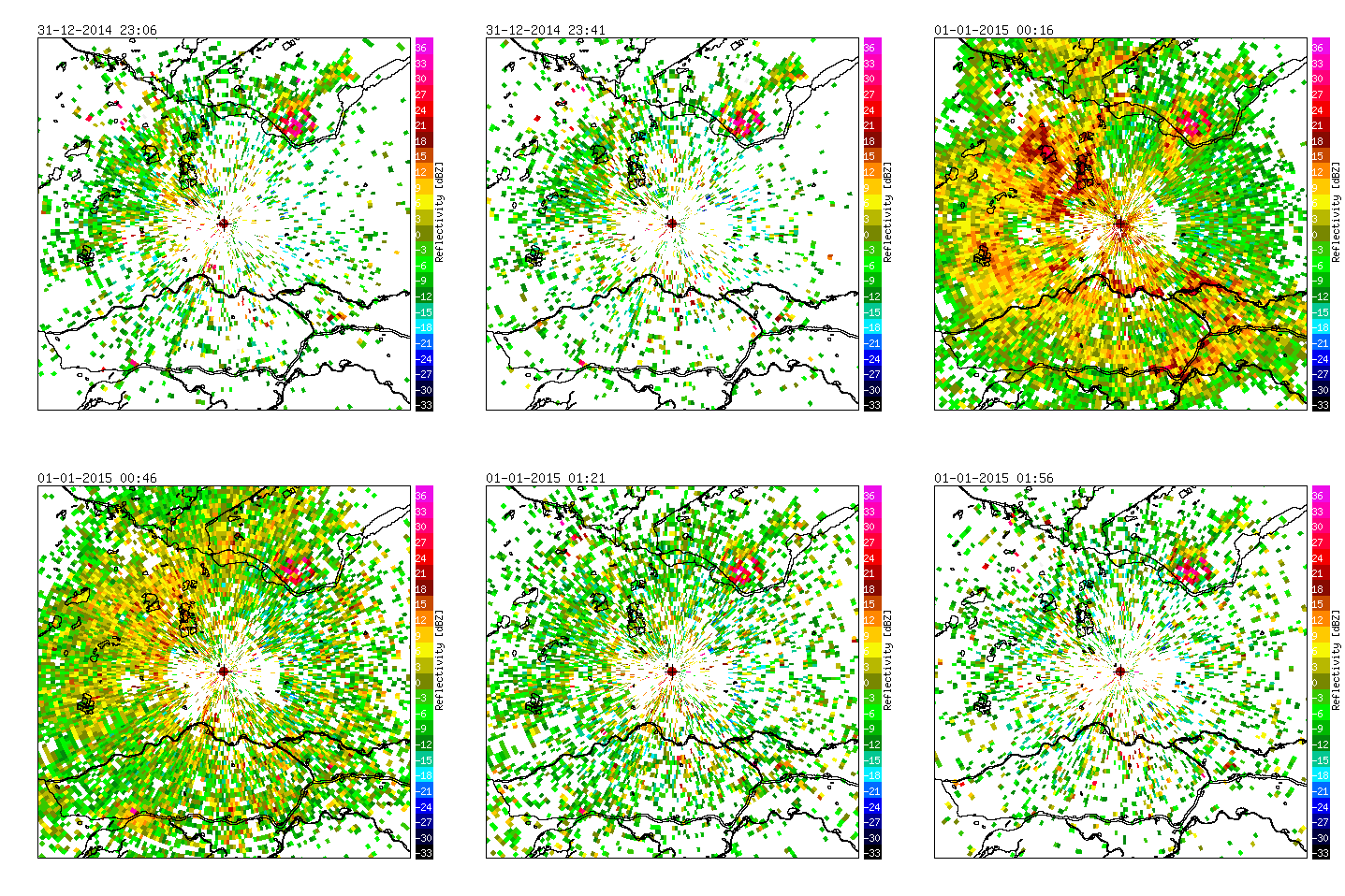
Radar measurements of De Bilt, 2014/2015. The eruption of red hotspots above lakes and rivers in the south of the radar images at 00:00 hours are from disturbed waterfowl roosting on those waterbodies during the night. Tens of thousands of roosting gulls, geese, Eurasian widgeons, but certainly also hundreds of Great Egrets which recently increased in this area.
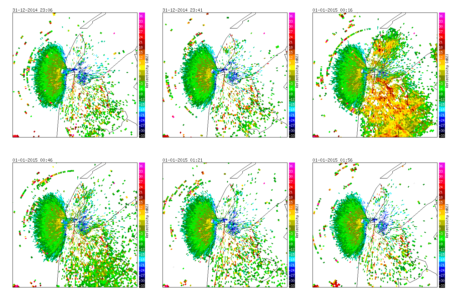
Radar measurements of Den Helder, 2014/2015. The big green spot on the left is from sea clutter. The incredible increase in radar reflectivity around 00:00 hours are from waders in The Waddensea (top) or geese, ducks and gulls in the south above land. At least >100,000 birds are affected by the explosion of fireworks at midnight.

Radar measurements of De Bilt, 2015/2016. The eruption of red hotspots above lakes and rivers in the south and west of the radar images at 00:00 hours are from disturbed waterfowl roosting on those waterbodies during the night. Birds went up to altitudes above 1000 meter, which lasted about 1.5 hours. The bird population in this area comprises tens of thousands of roosting gulls, geese, Eurasian widgeons, as well as hundreds of Great Egrets. In the forested eastern part of the radar, the birds seem to be disturbed less.
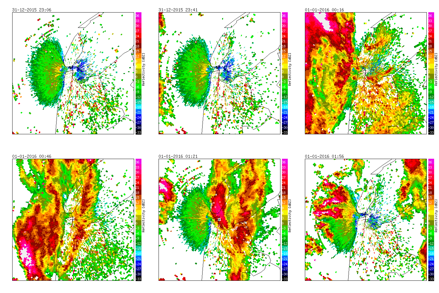
Radar measurements of Den Helder, 2015/2016. The incredible increase in radar reflectivity around 00:00 hours over The Waddensea are from waders and the increases over land are from geese, ducks and gulls. From 23:40, rain is starting to move in from the west (contiguous red patches). The semi-circular green spot direclty left from the radar is due to sea clutter.
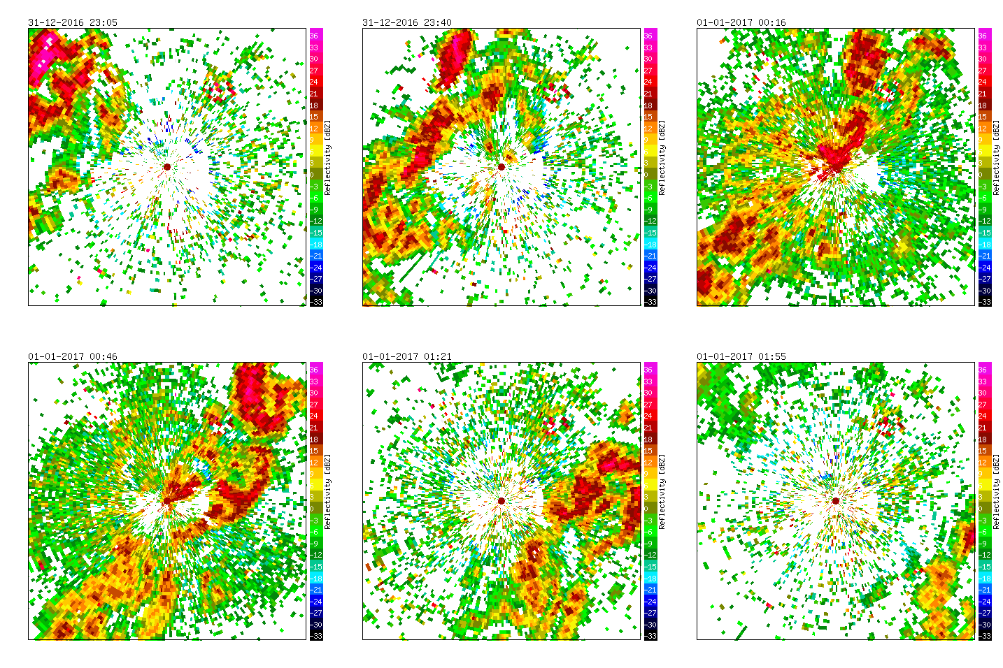
Radar measurements of De Bilt, 2016/2017. The eruption of red hotspots above lakes and rivers in the south and west of the radar images at 00:00 hours are from disturbed waterfowl roosting on those waterbodies during the night. Birds went up to altitudes above 1000 meter, which lasted about 1.5 hours. The bird population in this area comprises tens of thousands of roosting gulls, geese, Eurasian widgeons, as well as hundreds of Great Egrets. In the forested eastern part of the radar, the birds seem to be disturbed less.
The radar in Den Helder was not active in 2016/2017.
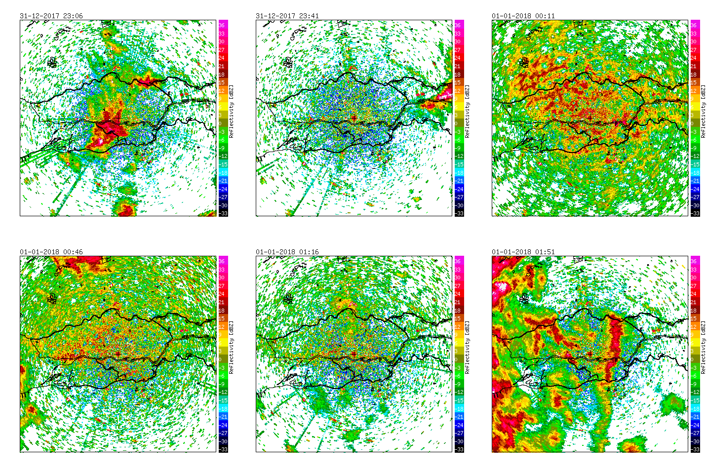
Radar measurements of Herwijnen (NL), 2017/2018.
Important areas for waterfowl around the Herwijnen radar are The Biesbosch (SW), the river area around the radar, and the Nieuwkoopse- and Reeuwijse plassen in the NW part of the image.
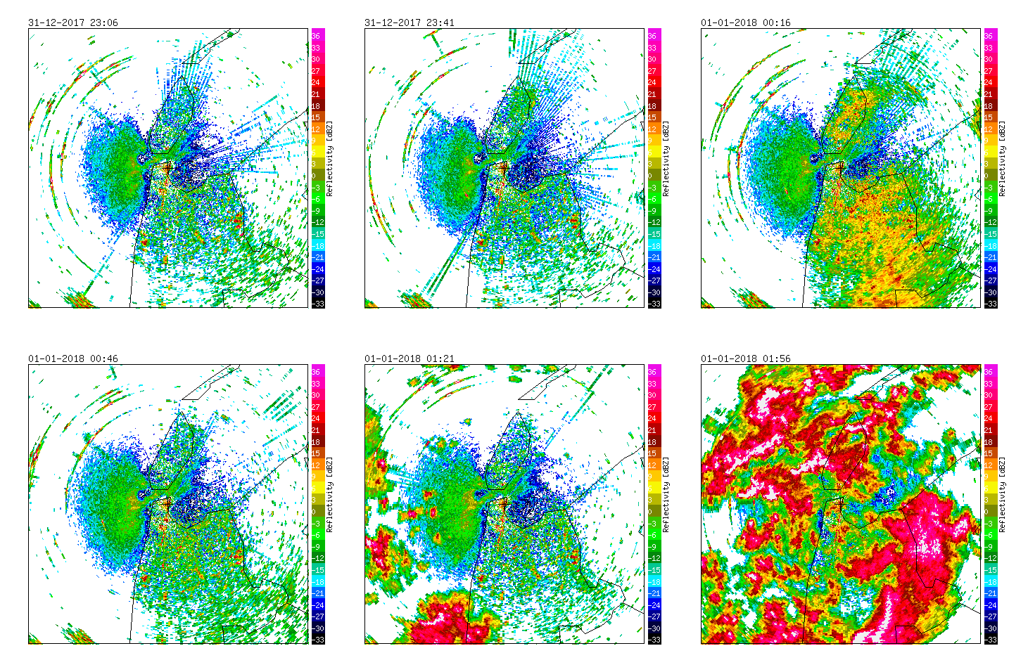
Radar measurements of Den Helder (NL), 2017/2018.
The weather radar in Den Helder is surrounded by important Natura 2000 areas for waterfowl including tens-of-thousands of waders and ducks (Waddensea, Texel and North Sea coastal area).
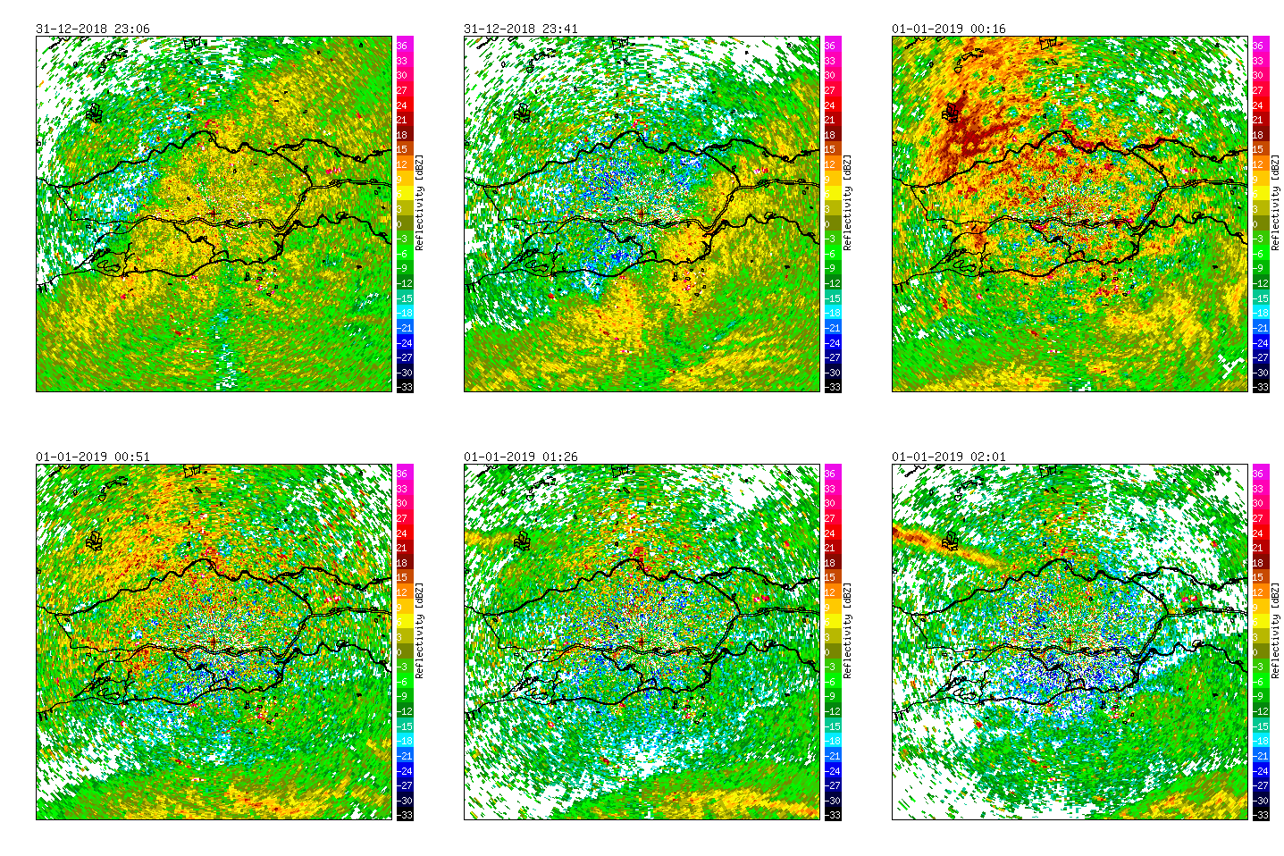
Radar measurements of Herwijnen (NL), 2018/2019.
Important areas for waterfowl around the Herwijnen radar are The Biesbosch (SW), the river area around the radar, and the Nieuwkoopse- and Reeuwijse plassen in the NW part of the image.
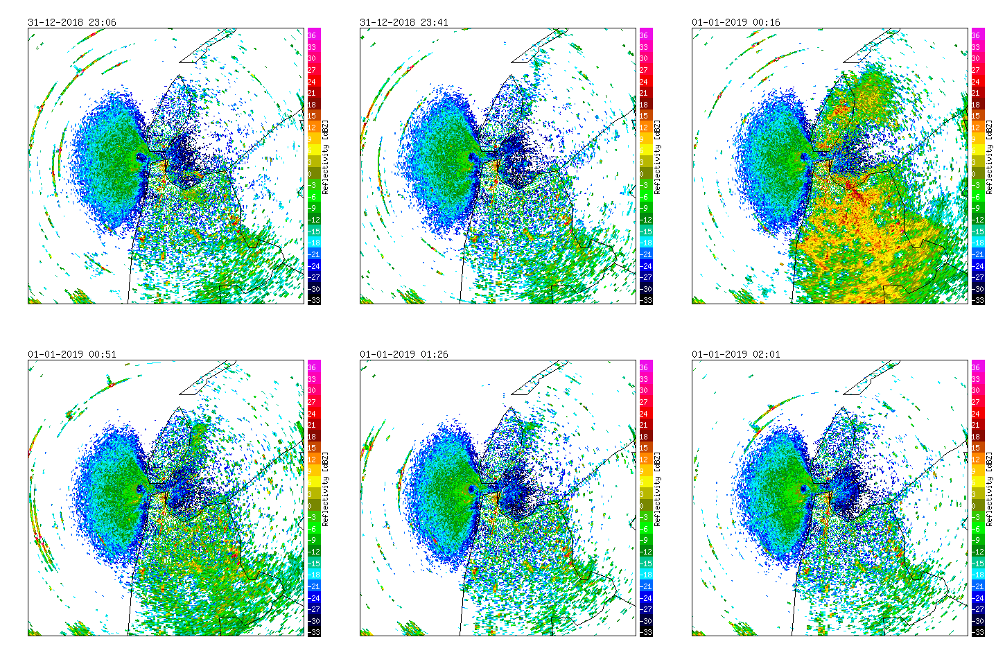
Radar measurements of Den Helder (NL), 2018/2019.
The weather radar in Den Helder is surrounded by important Natura 2000 areas for waterfowl including tens-of-thousands of waders and ducks (Waddensea, Texel and North Sea coastal area).
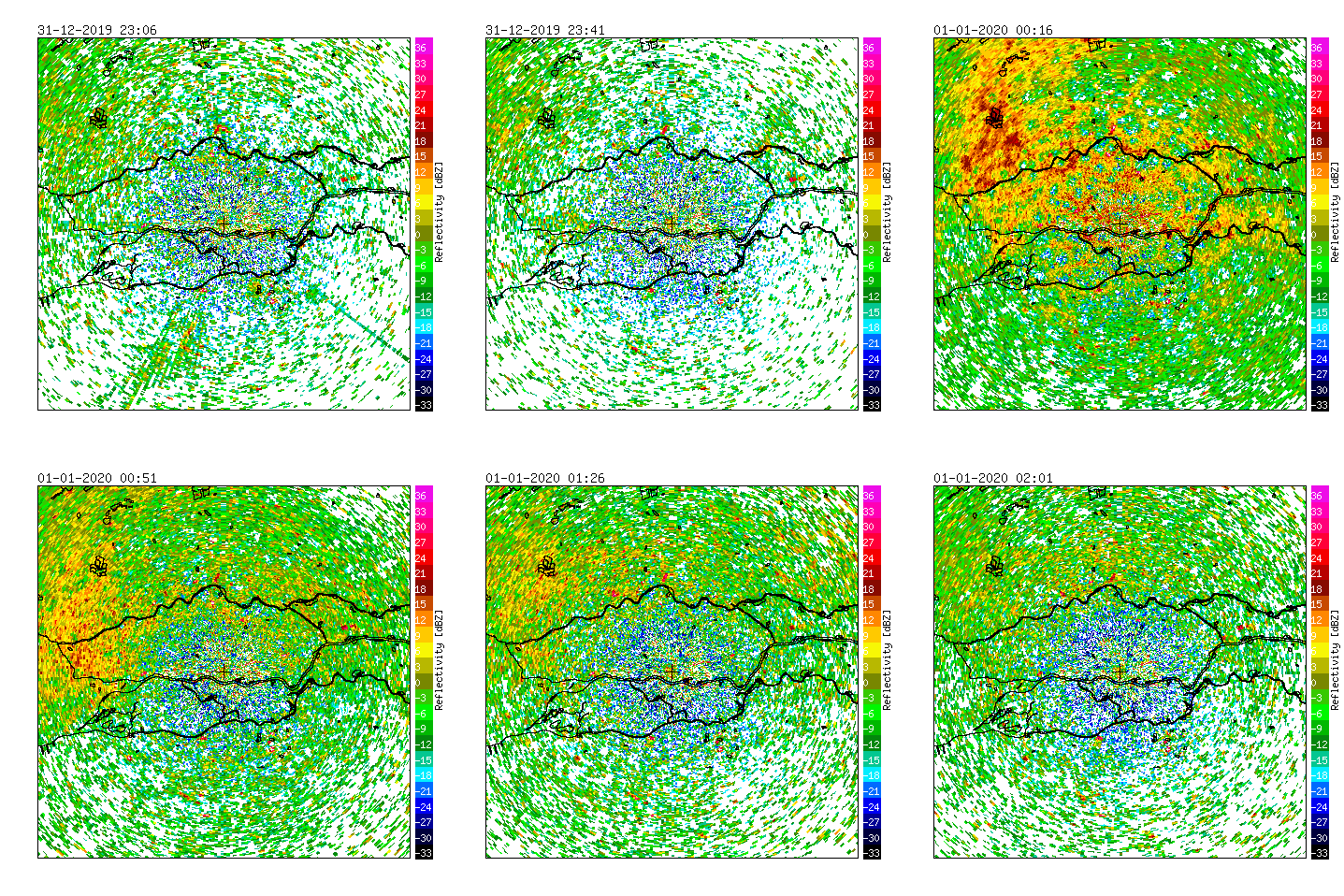
Radar measurements of Herwijnen (NL), 2019/2020.
Important areas for waterfowl around the Herwijnen radar are The Biesbosch (SW), the river area around the radar, and the Nieuwkoopse- and Reeuwijse plassen in the NW part of the image.
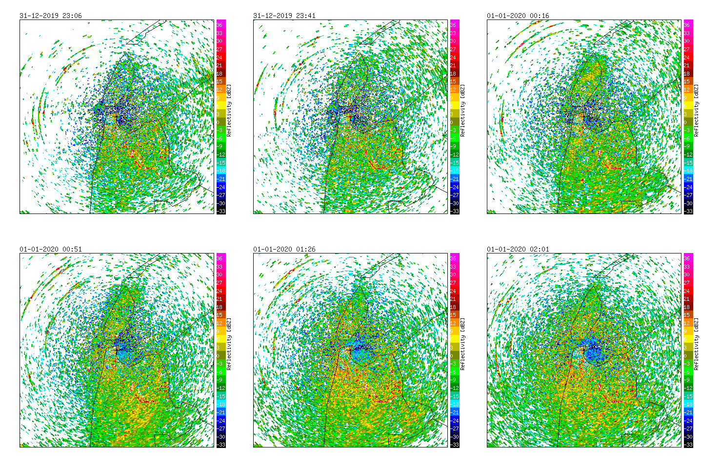
Radar measurements of Den Helder (NL), 2019/2020.
The weather radar in Den Helder is surrounded by important Natura 2000 areas for waterfowl including tens-of-thousands of waders and ducks (Waddensea, Texel and North Sea coastal area).
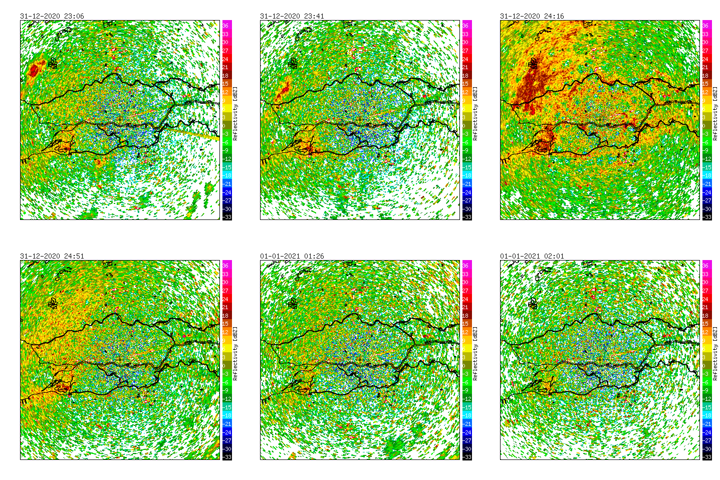
Radar measurements of Herwijnen (NL), 2020/2021.
Important areas for waterfowl around the Herwijnen radar are The Biesbosch (SW), the river area around the radar, and the Nieuwkoopse- and Reeuwijse plassen in the NW part of the image.
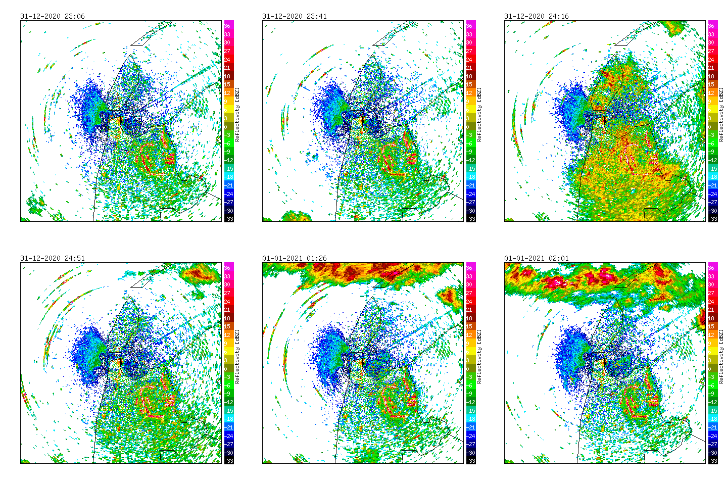
Radar measurements of Den Helder (NL), 2020/2021.
The weather radar in Den Helder is surrounded by important Natura 2000 areas for waterfowl including tens-of-thousands of waders and ducks (Waddensea, Texel and North Sea coastal area).
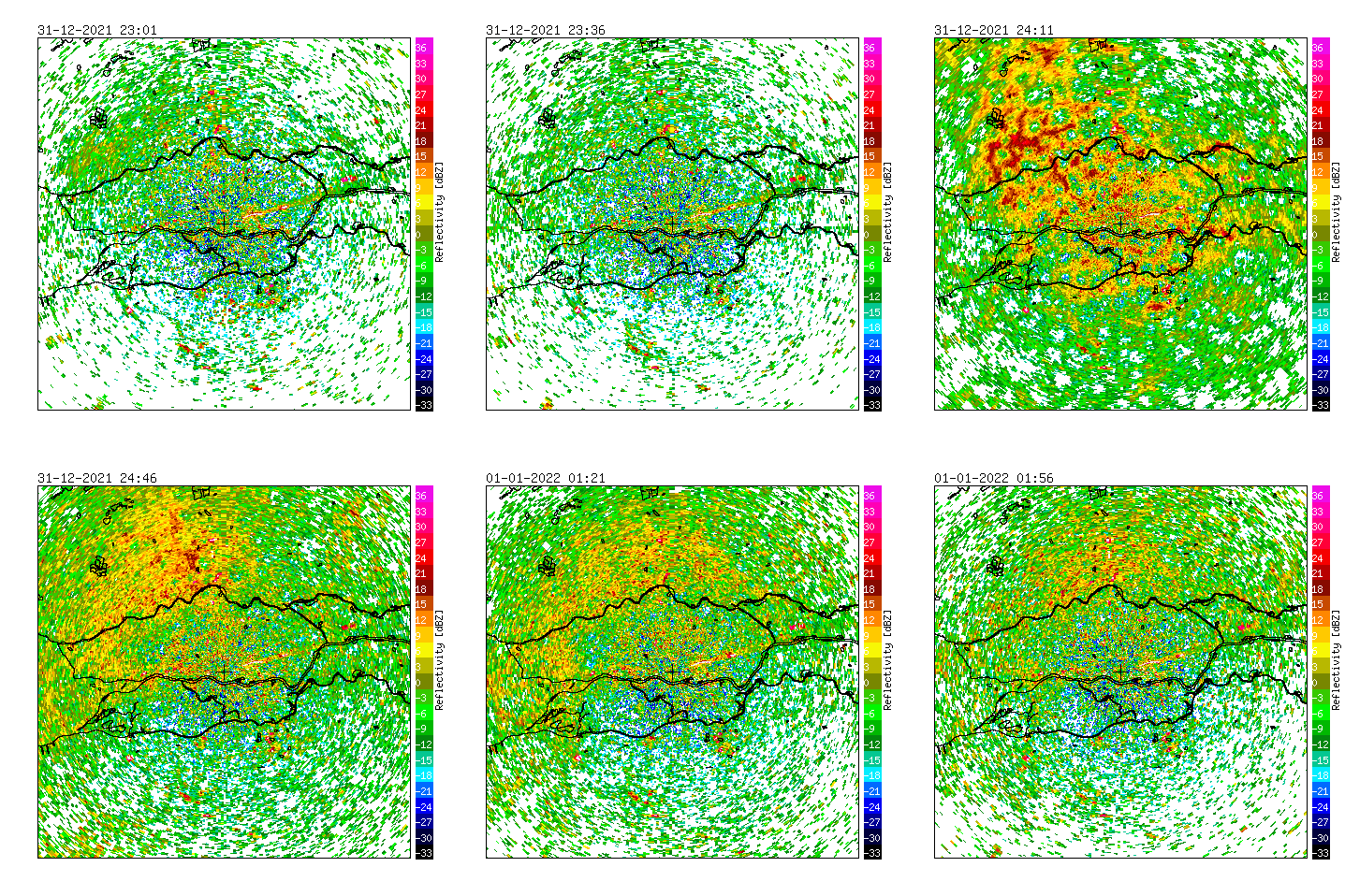
Radar measurements of Herwijnen (NL), 2021/2022.
Important areas for waterfowl around the Herwijnen radar are The Biesbosch (SW), the river area around the radar, and the Nieuwkoopse- and Reeuwijse plassen in the NW part of the image.
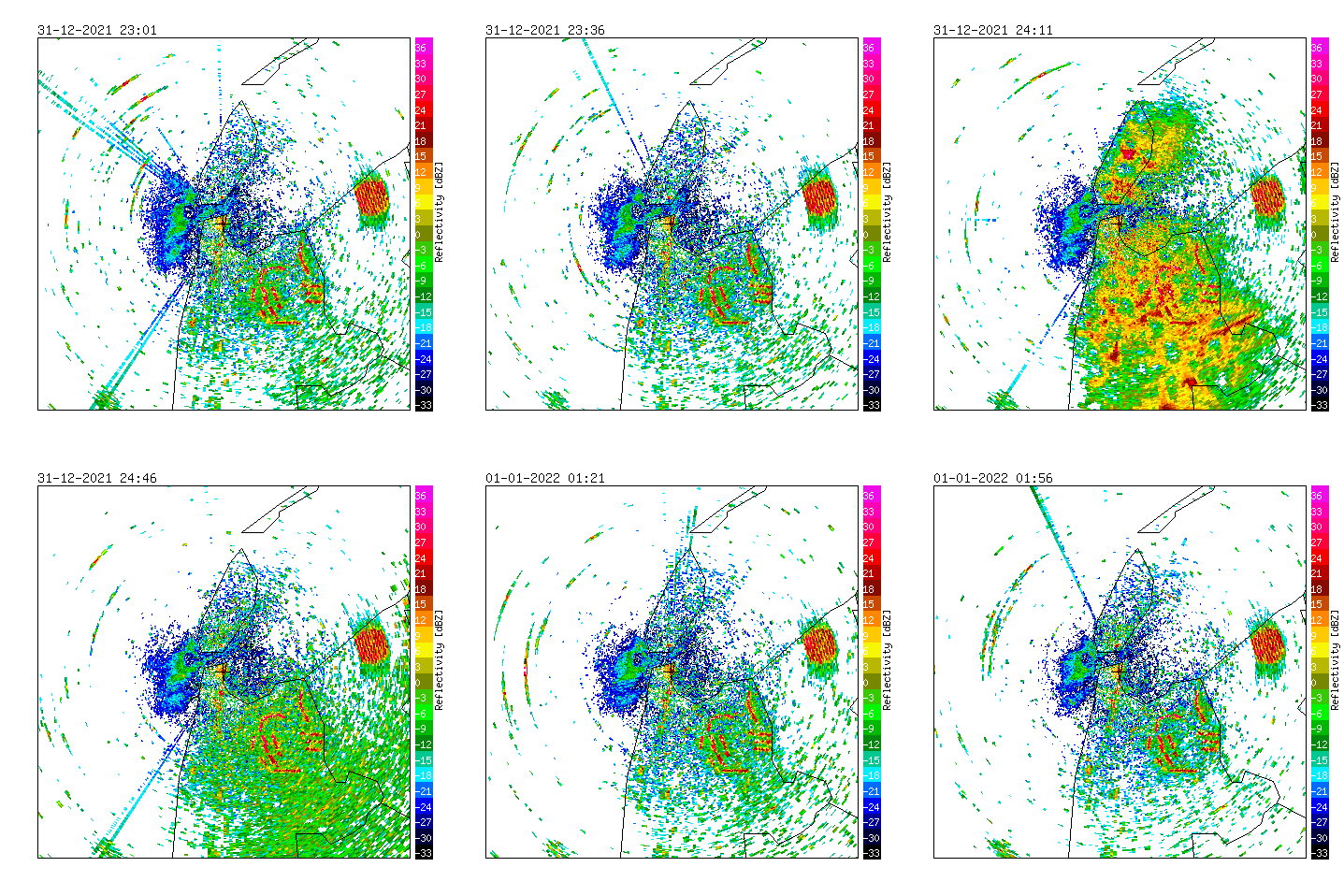
Radar measurements of Den Helder (NL), 2021/2022.
The weather radar in Den Helder is surrounded by important Natura 2000 areas for waterfowl including tens-of-thousands of waders and ducks (Waddensea, Texel and North Sea coastal area).
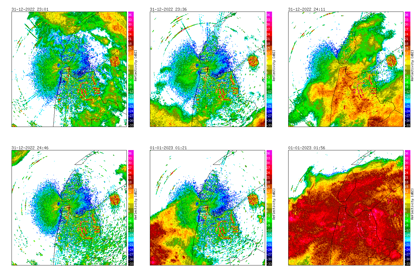
Radar measurements of Den Helder (NL), 2022/2023.
The weather radar in Den Helder is surrounded by important Natura 2000 areas for waterfowl including tens-of-thousands of waders and ducks (Waddensea, Texel and North Sea coastal area).
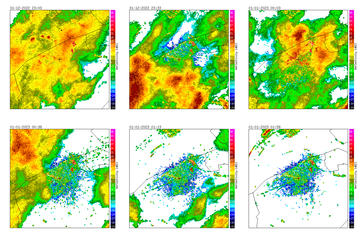
Radar measurements of Jabbeke (BE), 2022/2023.
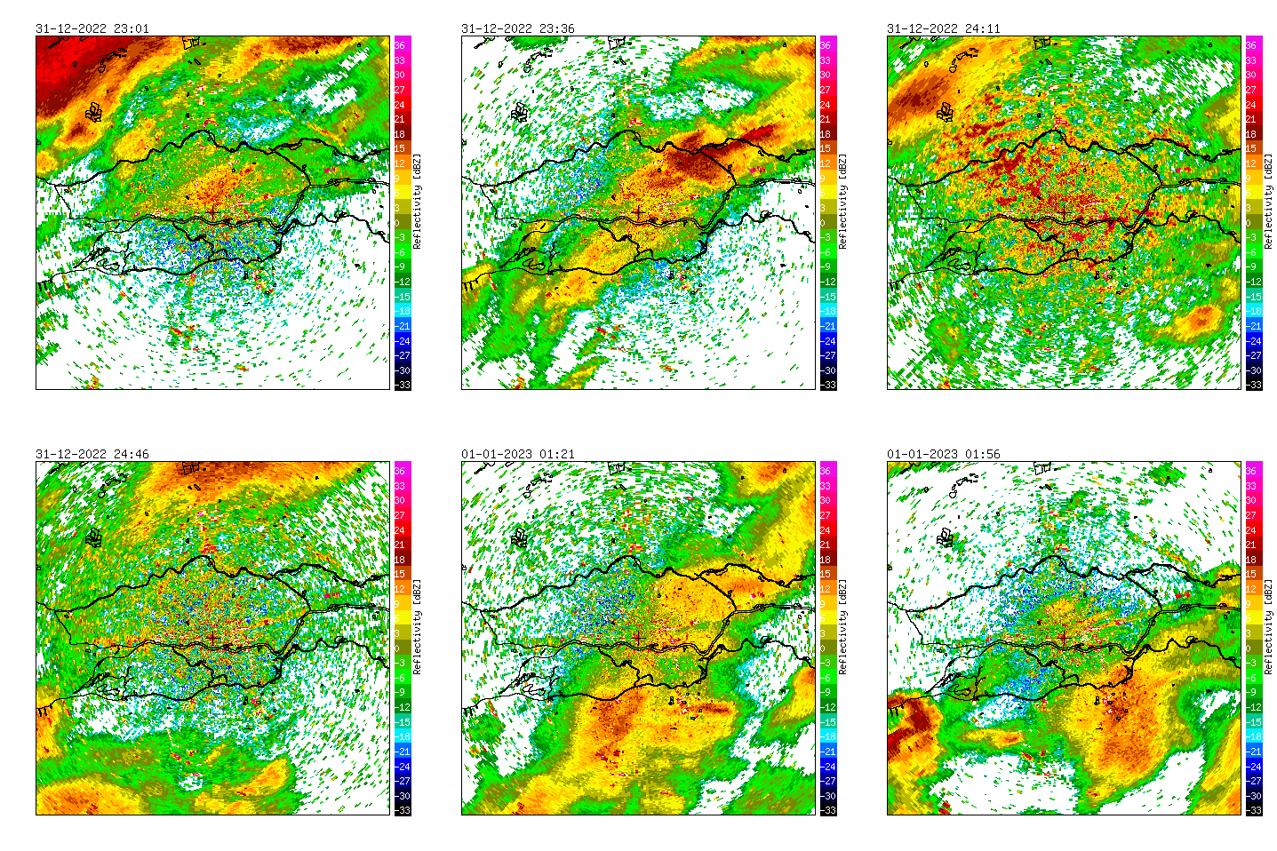
Radar measurements of Herwijnen (NL), 2022/2023.
Important areas for waterfowl around the Herwijnen radar are The Biesbosch (SW), the river area around the radar, and the Nieuwkoopse- and Reeuwijse plassen in the NW part of the image.
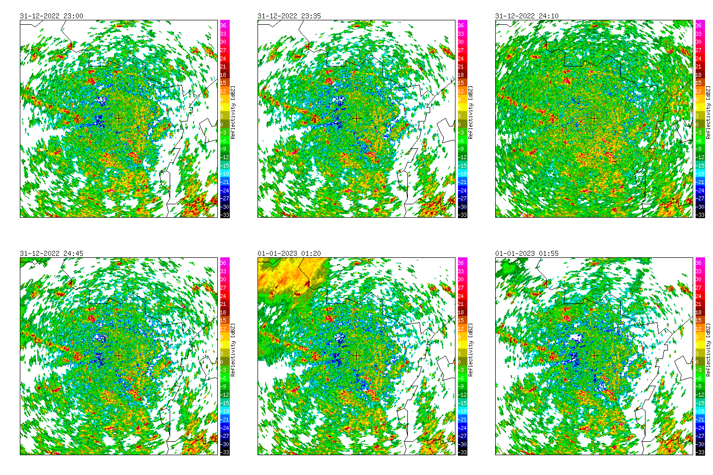
Radar measurements of Helchteren (BE), 2022/2023.
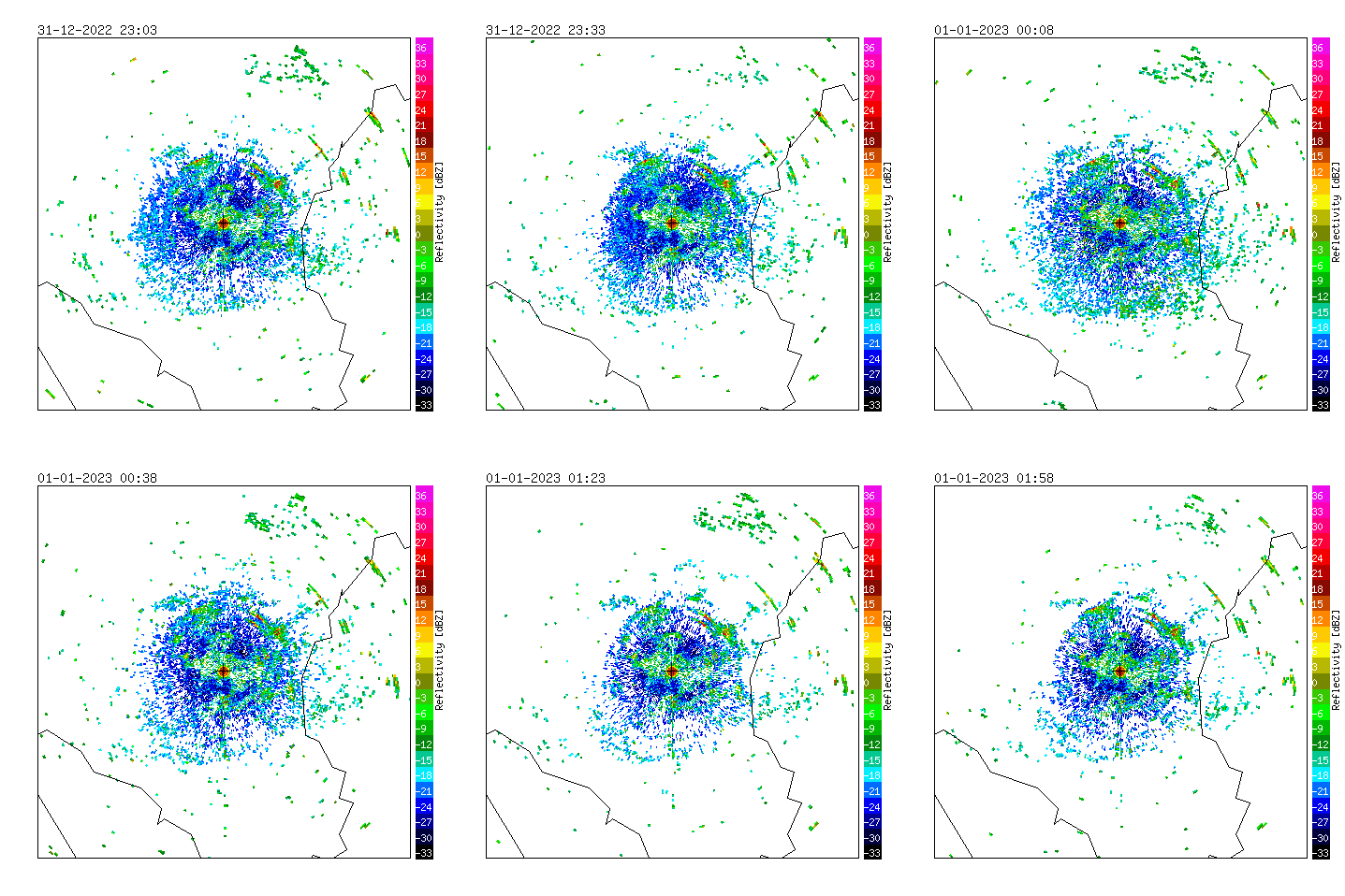
Radar measurements of Wideumont (BE), 2022/2023.
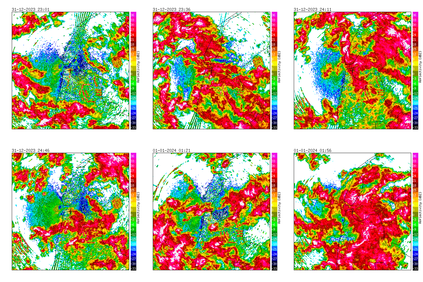
Radar measurements of Den Helder (NL), 2023/2024.
The weather radar in Den Helder is surrounded by important Natura 2000 areas for waterfowl including tens-of-thousands of waders and ducks (Waddensea, Texel and North Sea coastal area).
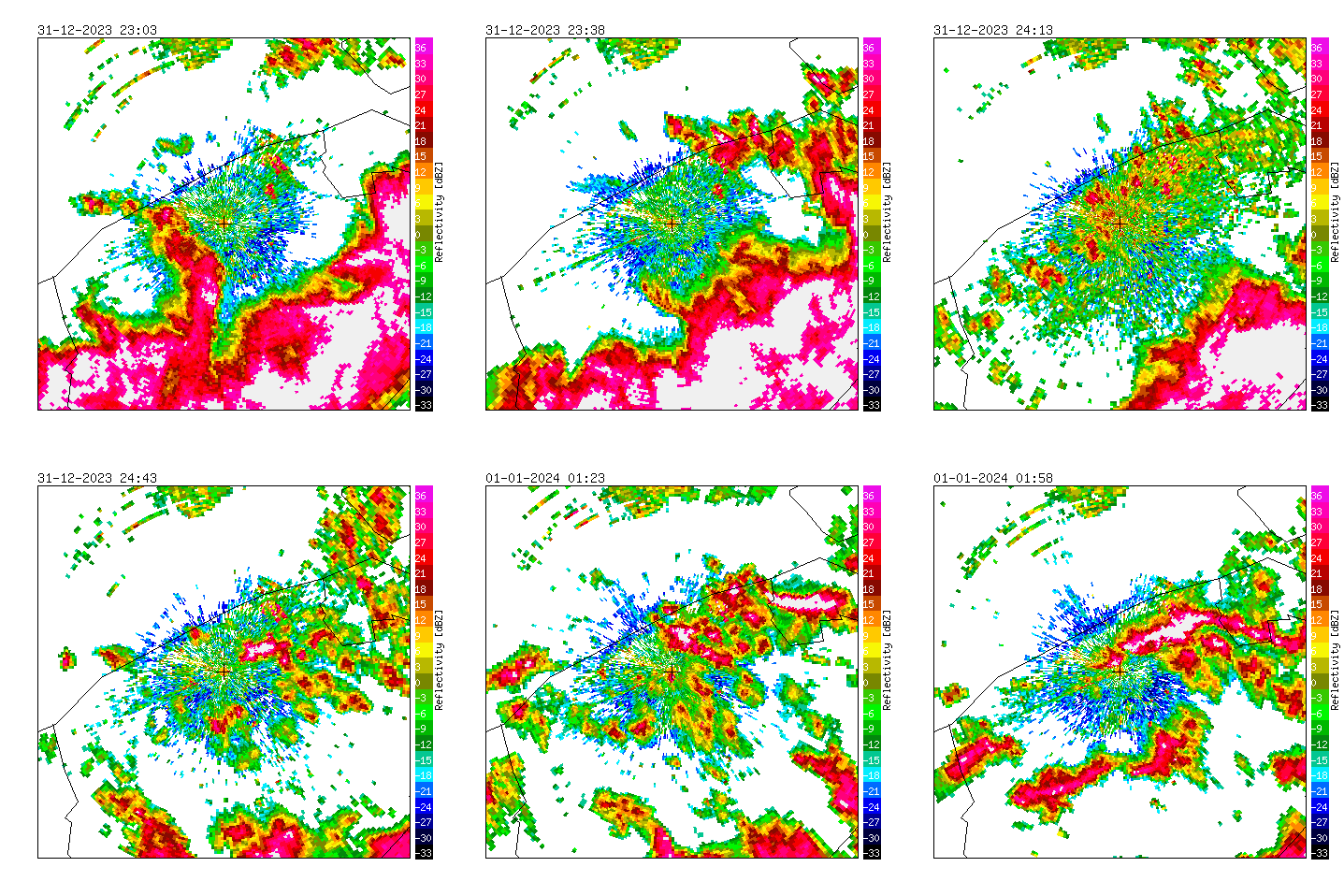
Radar measurements of Jabbeke (BE), 2023/2024.
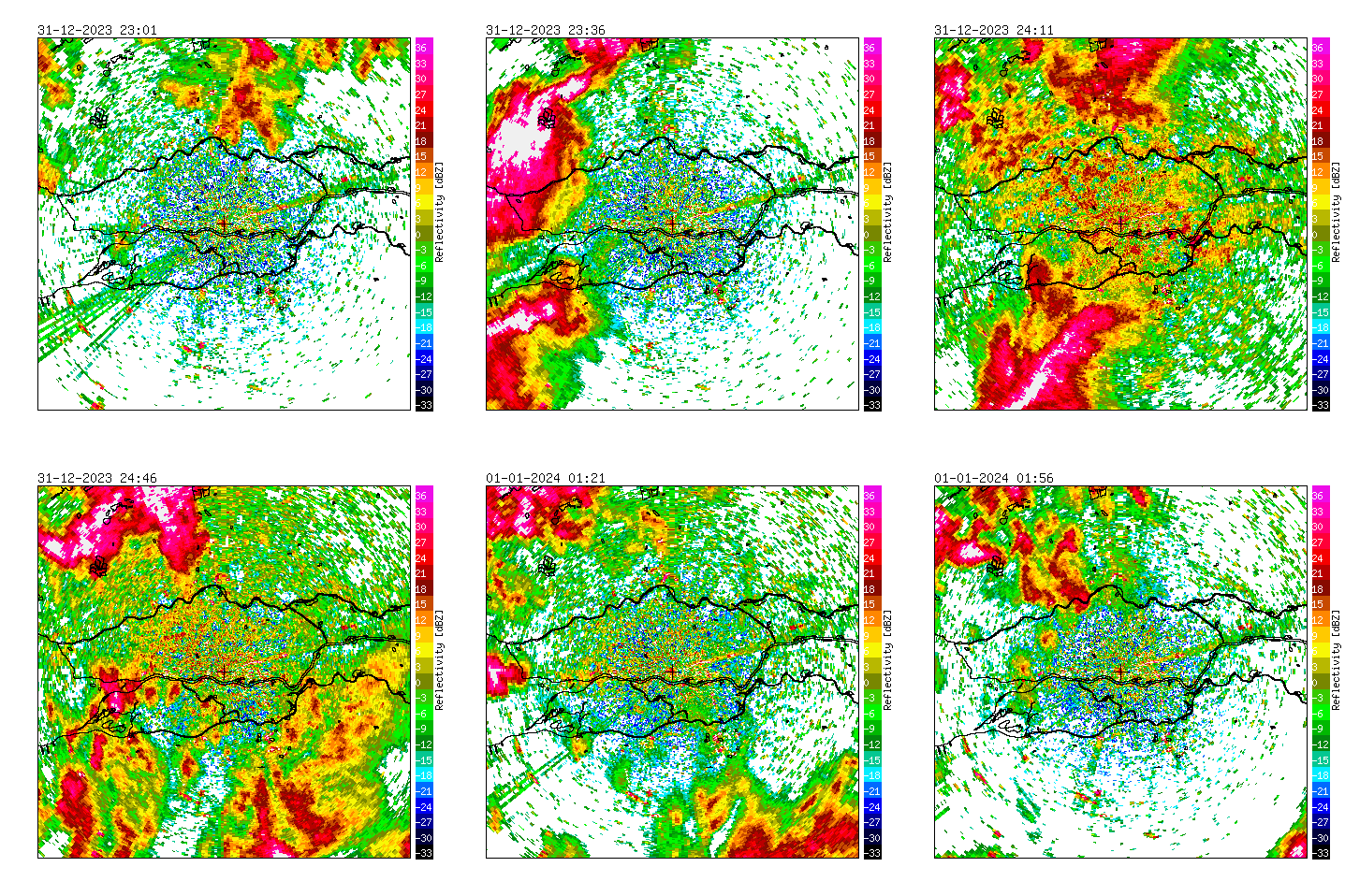
Radar measurements of Herwijnen (NL), 2023/2024.
Important areas for waterfowl around the Herwijnen radar are The Biesbosch (SW), the river area around the radar, and the Nieuwkoopse- and Reeuwijse plassen in the NW part of the image.
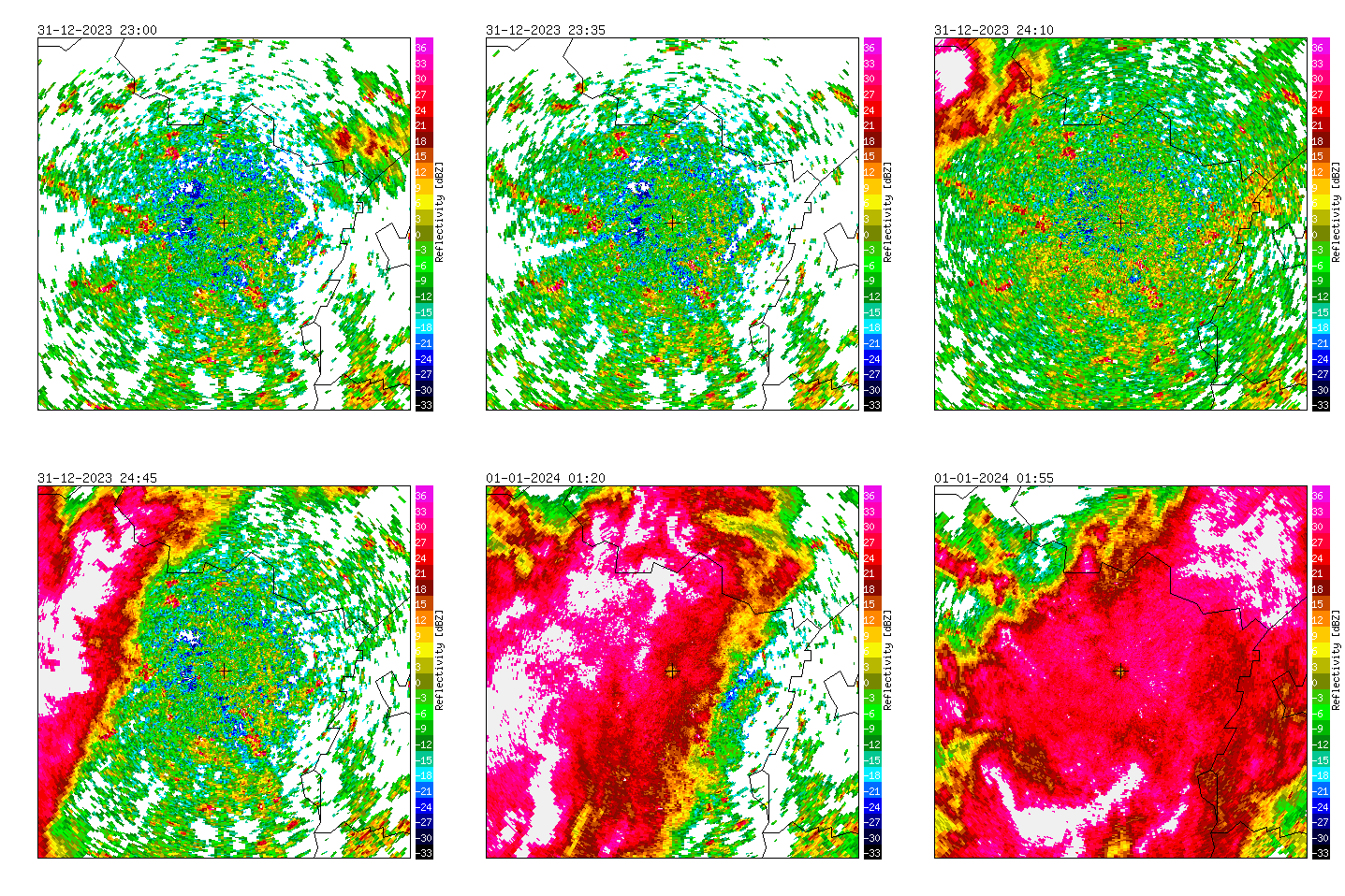
Radar measurements of Helchteren (BE), 2023/2024.
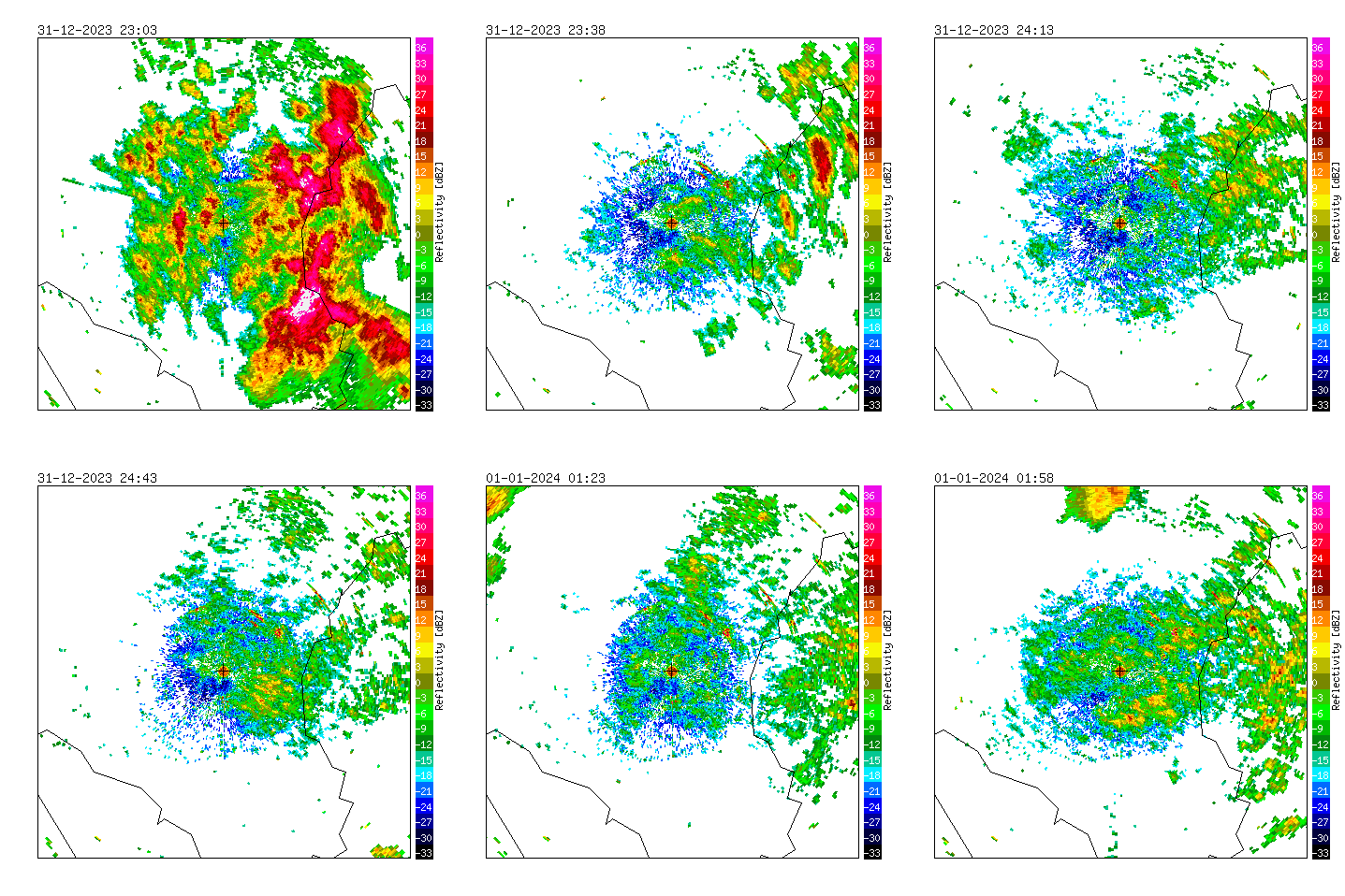
Radar measurements of Wideumont (BE), 2023/2024.
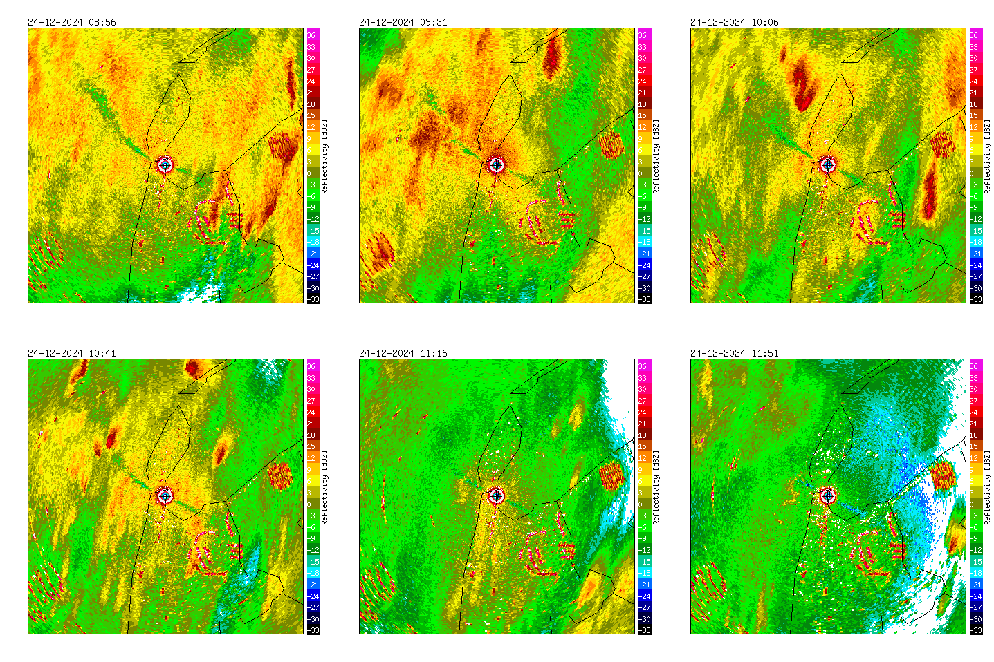
Radar measurements of Den Helder (NL), 2024/2025.
The weather radar in Den Helder is surrounded by important Natura 2000 areas for waterfowl including tens-of-thousands of waders and ducks (Waddensea, Texel and North Sea coastal area).
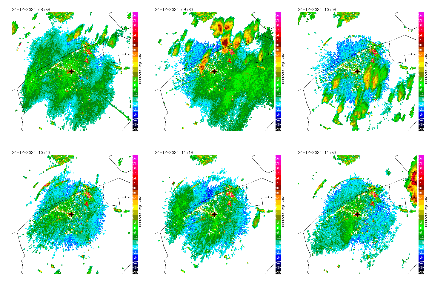
Radar measurements of Jabbeke (BE), 2024/2025.
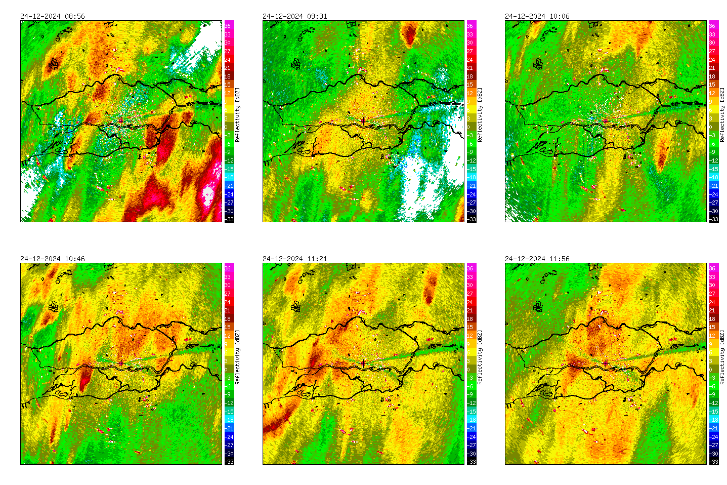
Radar measurements of Herwijnen (NL), 2024/2025.
Important areas for waterfowl around the Herwijnen radar are The Biesbosch (SW), the river area around the radar, and the Nieuwkoopse- and Reeuwijse plassen in the NW part of the image.
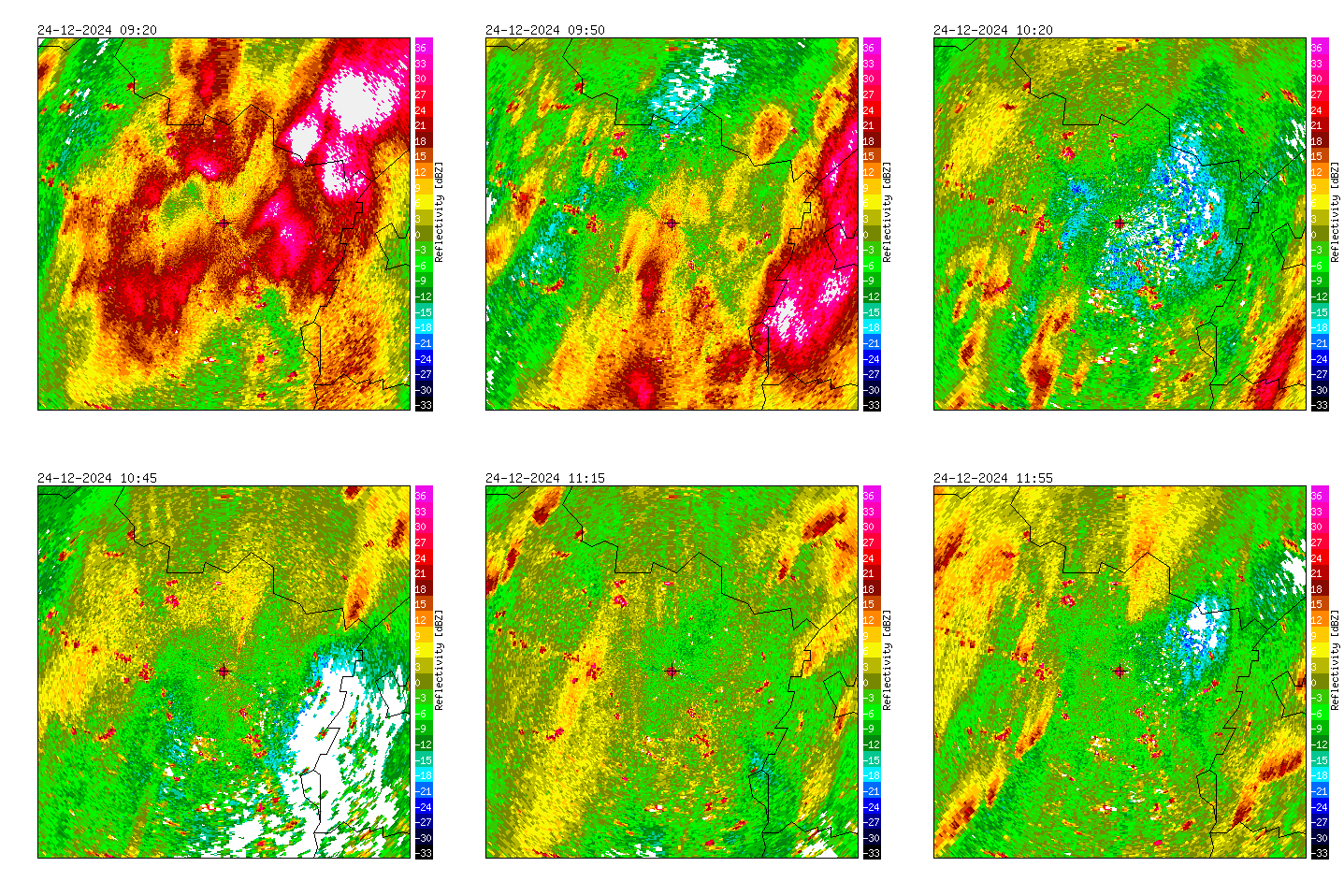
Radar measurements of Helchteren (BE), 2024/2025.
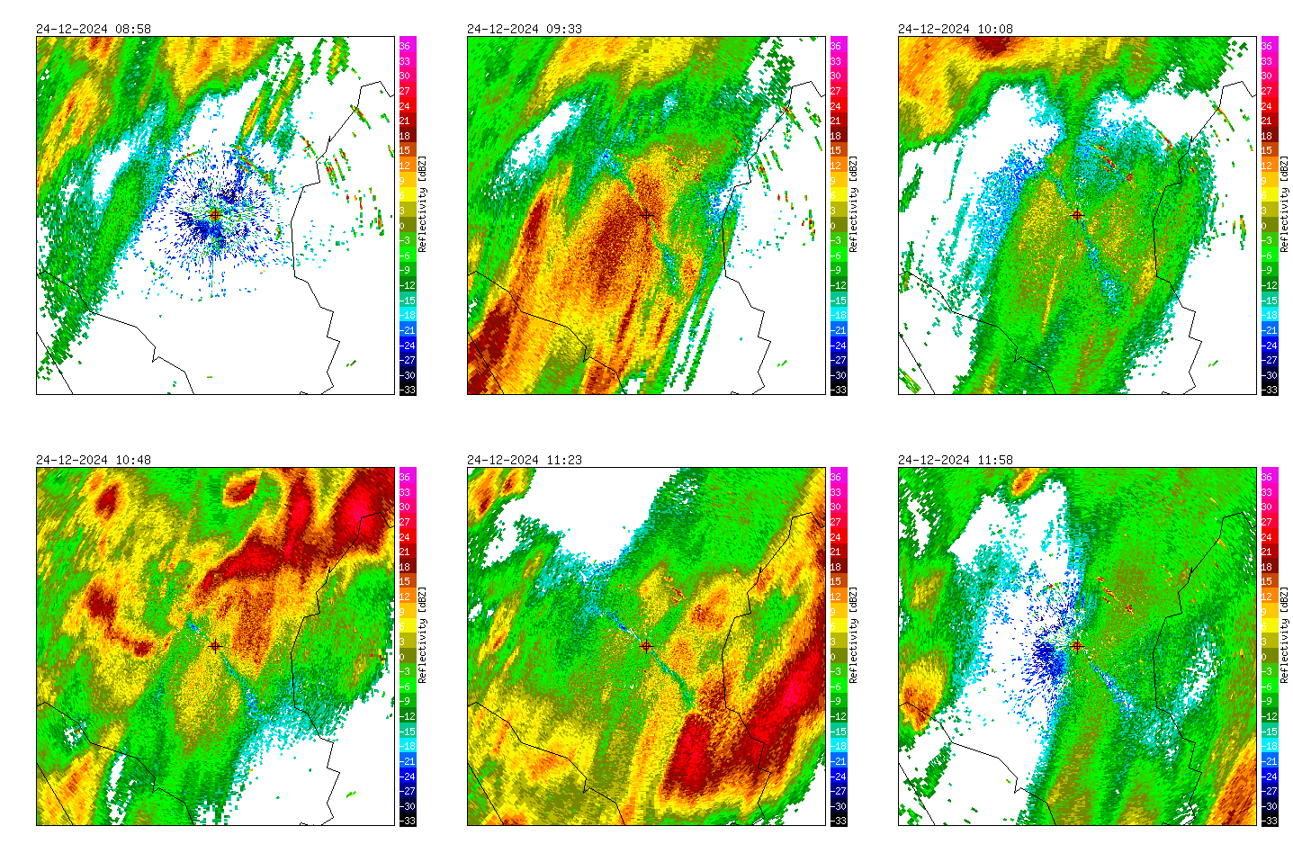
Radar measurements of Wideumont (BE), 2024/2025.
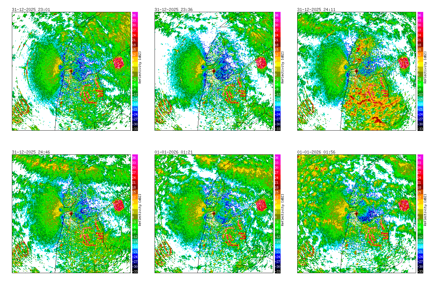
Radar measurements of Den Helder (NL), 2025/2026.
The weather radar in Den Helder is surrounded by important Natura 2000 areas for waterfowl including tens-of-thousands of waders and ducks (Waddensea, Texel and North Sea coastal area).
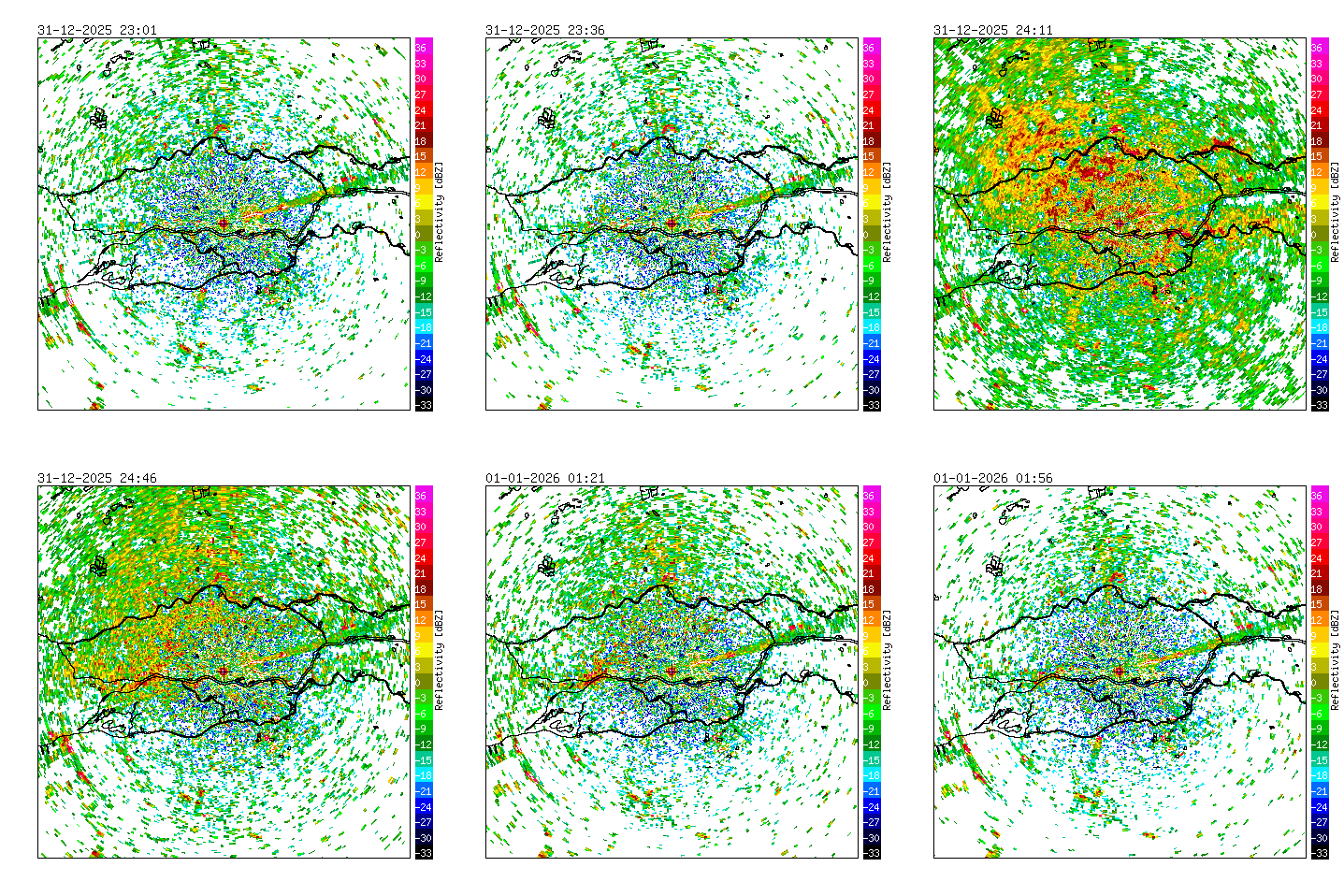
Radar measurements of Herwijnen (NL), 2025/2026.
Important areas for waterfowl around the Herwijnen radar are The Biesbosch (SW), the river area around the radar, and the Nieuwkoopse- and Reeuwijse plassen in the NW part of the image.
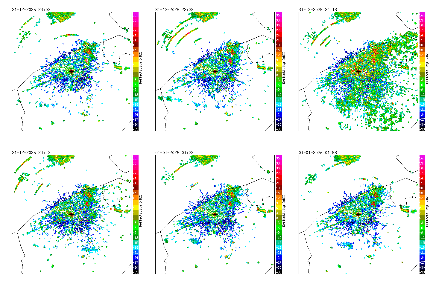
Radar measurements of Jabbeke (BE), 2025/2026.
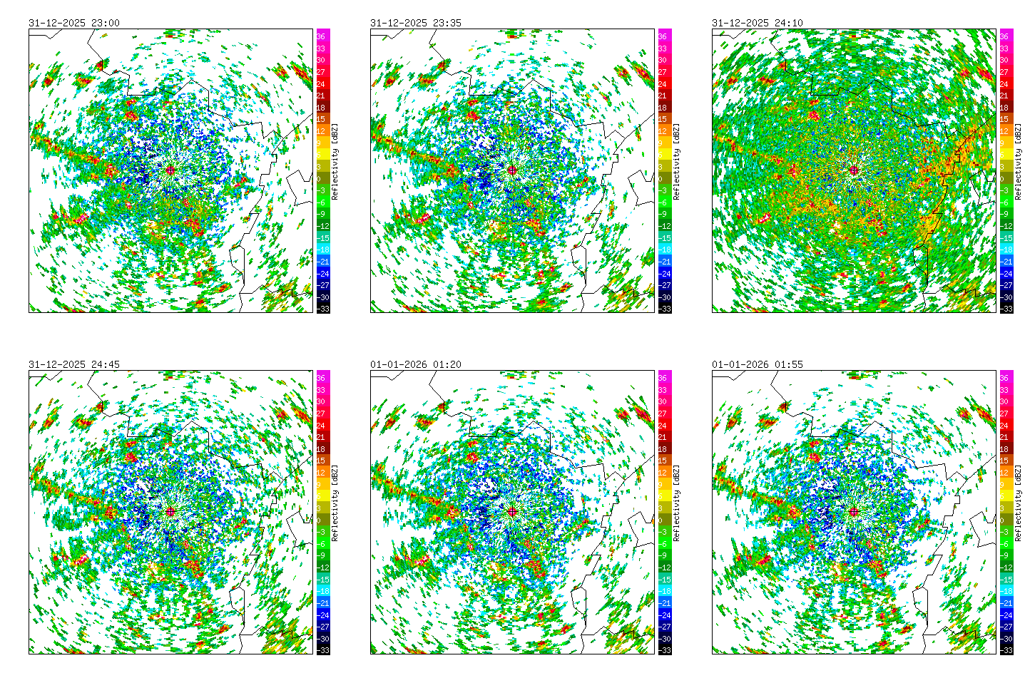
Radar measurements of Helchteren (BE), 2025/2026.
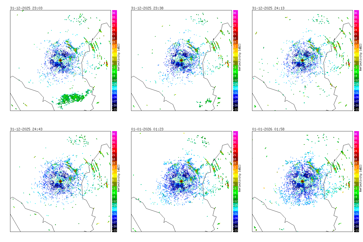
Radar measurements of Wideumont (BE), 2025/2026.


